
REVIEW · SPLIT CITY & DAY TOURS
From Brač: Panoramic Flight over Brač, Hvar, Šolta, & Split
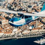
One hour above the Adriatic feels like a shortcut to postcard Croatia. This panoramic flight is built around recognizable island highlights you can actually see in context: Brač, Hvar, Šolta, and then Split. I also like that it stays personal with a private group setup and an experienced guide up front.
You get a high-return route for the time: the flight starts over Zlatni rat near Bol, then tracks across Hvar with stops like Vrboska, Jelsa, and Starigrad. From above, the details that are hard to understand on the ground, cliffs dropping into the sea, where bays open, and how towns sit along the water, suddenly make sense.
One drawback to keep in mind: the name can make some people think helicopter, but this is a panoramic flight. And like all aerial plans here, it can be adjusted or canceled due to weather or weight limits.
Key moments that make this flight worth it
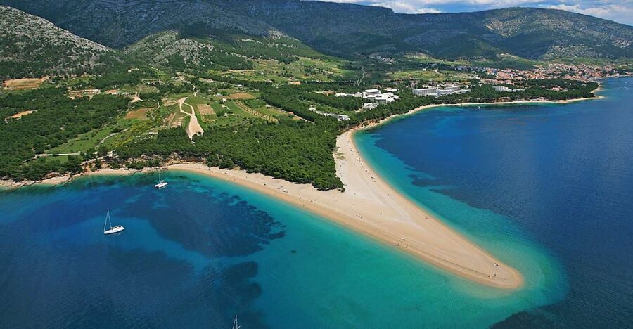
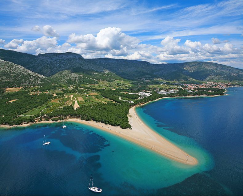
- Zlatni rat near Bol from the air, with the coastline geometry made clear
- Vrboska to Starigrad views that show how Hvar towns cluster along the shoreline
- Tvrdalj and Petar Hektorović’s castle with the sea-water fishpool and dovecote tower
- Hvar Town’s observatory area seen from above, not just as a dot on a map
- Šolta’s high cliffs plus Stomorska on the north side for that classic bay feel
- Split flyover and a return arc toward Supetar on Brač
Why this 1-hour panoramic route beats a typical day on the ground
If you only have limited time on Brač, it’s hard to do everything without feeling rushed. This flight is a practical fix. In one hour, you get an aerial overview of the islands and the city, so you understand what you later want to revisit on foot.
What I like most is the way the route connects places you already associate with Dalmatia. You’re not just flying from point A to point B and hoping for views. The route is structured around the recognizable shoreline patterns, the famous coastal stretch near Bol, and the “island life” towns you’d otherwise spend days driving to.
The other big value is perspective. From sea level, Hvar and Šolta can feel like a bunch of coastal villages and viewpoints. From the air, you can see where the cliffs cut in, where the bays soften, and why some harbors feel protected and others look exposed. It’s the kind of clarity that makes your next day plans easier.
You can also read our reviews of more tours and experiences in Brac Island.


Brač Airport to takeoff: getting set for an easy, guided flight
The experience begins at Brač Airport. You’ll be flying with an experienced pilot/guide, and the driver is listed as English and Croatian. That matters because you’re not stuck staring out a window with zero context. You can ask quick questions, and the guide helps you connect what you’re seeing to what it means on the island.
You should also plan to dress for comfort over style. The activity notes suggest comfortable clothes and shoes, plus a camera. That’s a hint that even if most of the experience is in the air, you’ll likely spend time on the ground before and after, and you’ll want to move without fuss.
Because it’s a private group, you’re also not waiting for a crowd to board and debate sunscreen. It’s closer to a tailored outing. Up to three people per group is a sweet spot for this kind of aerial sightseeing.
From Zlatni rat to Hvar: why the coastline looks different from the air
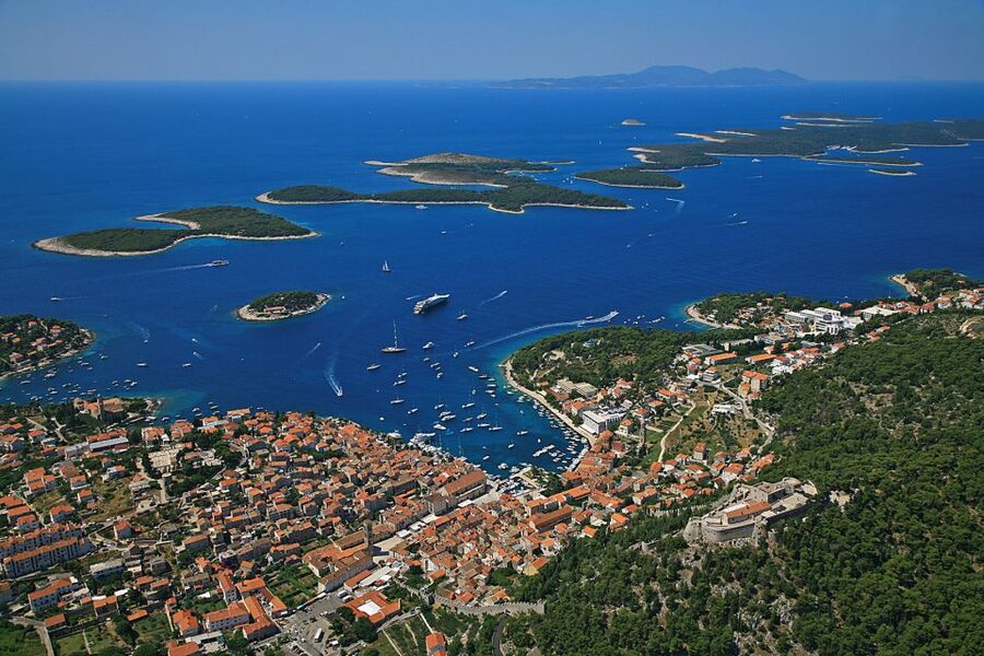
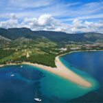
The flight route starts with a pass over Zlatni rat near Bol, one of Croatia’s best-known beaches. From above, you see more than the beach itself. You see how the shoreline curves, how the land fingers into the sea, and how the water color shifts with depth and exposure.
Then you head toward the island of Hvar. This is where aerial views become genuinely useful. Hvar’s coast is famously scenic, but it can be confusing to picture while you’re on a bus or walking along the promenade. From the air, the towns stop looking random and start looking intentional, placed in specific pockets of coastline.
You’ll continue the flight over Vrboska, which is described as one of Hvar’s most picturesque villages. Vrboska is a name that many people hear, but seeing it from above helps you understand why it works as a village spot: the waterways and harbor setting make a lot more sense when you can see the layout in one frame.
Vrboska, Jelsa, Starigrad, and Tvrdalj’s Petar Hektorović details
After Vrboska, the route includes flying by Jelsa and Starigrad. This is a nice sequence because it gives you a spread of Hvar’s shoreline mood. Some stretches look open and dramatic, while others feel calmer and more sheltered from typical sea exposure.
Then comes one of the most specific, memorable moments: the flight over Tvrdalj, the summer residence of Petar Hektorović. What’s cool here is that you’re not only getting a view of a building. You’re seeing the setting described as a sea-water fishpool, plus a tower with a dovecote. Even if you don’t know the names from history class, those details give the place identity.
This is also one of the best examples of why aerial sightseeing can be more than just pretty pictures. On the ground, you might see a structure and move on. From the air, you can see how the residence relates to the coastline and why it sits where it does. It helps you appreciate the “why” behind the view, not only the “wow.”
If you care about photography, this is the part of the route where your camera work actually benefits from planning. When you spot Tvrdalj, you’ll want to be ready early, not after you already missed the angle.
Over Hvar Town and the observatory above it
Next you fly toward the town of Hvar, described as the administrative center of the island and a major tourist destination. From above, town centers can look like compact shapes. But Hvar shows a more layered feel, with the harbor area and surrounding coastline clearly readable.
Above the city is an observatory, used for both tourist and scientific purposes. That’s a detail worth paying attention to during the flight. Even if you don’t visit it afterward, you’ll have a better sense of where it sits in relation to the town and why it’s visible from different angles.
This section also helps you mentally map your future day. If you’re choosing between beaches, viewpoints, or walking routes on Hvar, this kind of overhead context makes those choices faster. You can look at the shoreline, then decide what looks walkable and what looks like a “time-saver” that you should reach by ferry or car.

Hvar Channel to Šolta: cliffs, fishing villages, and Stomorska
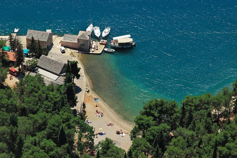
After Hvar, the flight crosses the Hvar Channel toward Šolta. The route description includes “untouchable high cliffs” on the south side of the island, flowing into the sea. That phrasing is dramatic, but from the air it’s exactly what you’d expect: cliff edges and sea access are often far more extreme than they appear from land.
On the north side of Šolta, the flight passes by old fishing villages in bays, including Stomorska. This is a different visual vibe than the cliffs. Bays create a softer, more enclosed look, and fishing villages often show a mix of shoreline structure and small harbor patterns.
I really like this contrast because it prevents the flight from feeling repetitive. You get rugged coastline, then sheltered bays, then recognizable villages again. It’s a good reminder that Dalmatia is not one single “look.” Each island has its own geography, and the flight lets you see that quickly.
Split flyover and the return arc toward Supetar
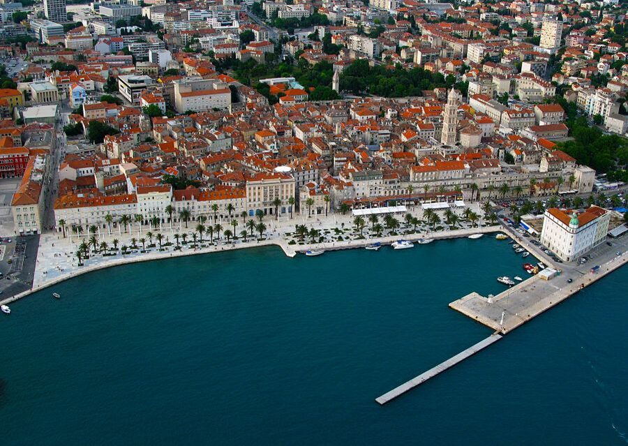
The flight ends by flying over Split, then turning back across the Brač Channel toward Supetar on Brač. That ending matters. Many aerial tours focus only on the islands and leave you with a sense of “floating island hopping.” Here, you also get a city perspective.
Seeing Split from above can help you connect the city’s layout to the way the coastline wraps around it. And once you return toward Supetar, you get an easy mental anchor for the end of the day on Brač.
If you’re planning more travel afterward, this is a helpful moment. You’ll understand the scale of distances between islands and the coastline shapes, so your ferry or drive decisions feel less like guessing.
Pilot, private group, and what you’re really paying for
The price is listed at $547 per group up to 3, and that group size is part of the value. You’re not buying a seat for ten people and hoping the pilot talks to everyone. You’re buying a focused hour, with an experienced pilot/guide and insurance and fees included.
What stands out from the feedback is the human part. A review from Germany praised the professional handling and conversation, thanks to Patrick and Jasmin. Another review from Spain mentioned that when weather prevented the flight at the scheduled time, the company arranged an alternative time, with clear communication from Iván, the owner. That’s not just comfort. It’s risk management, and it protects your schedule when the sky decides to be moody.
There is also an honest note about expectations. One review pointed out confusion from the activity title, where it sounded like a helicopter flight. If you want to avoid disappointment, set your expectations to panoramic flight, not helicopter. The best outcome comes when you’re excited for the view, not the aircraft type.
Food and drink are not included, so treat this like a light outing in terms of logistics. Plan your meals around it rather than assuming you’ll be served during the flight.
Practical tips for the best photos and a calmer experience
Aerial photos are all about timing and comfort. You’ll want a camera ready and your settings sorted before you reach the key viewpoints. If your phone is your camera, charge it fully beforehand and consider using a case that’s easy to grip.
Wear comfortable clothes and shoes. It may seem small, but you’ll feel better if you can move easily at departure and arrival. Also, keep your upper layer accessible, since air can feel cooler depending on the flight conditions.
Because all times are approximate and can change due to weather conditions and weight restrictions, be flexible with the rest of your day. Try not to stack a critical appointment right after your booked time. Build in buffer time so a schedule shift does not knock your plans sideways.
Finally, go in with curiosity. This is not a silent sightseeing moment. The guide experience, with English or Croatian support, is part of the value. Ask quick questions like what you’re looking at, or what viewpoint the route is emphasizing.
Weather can change things, so plan like a local
This activity notes that it could be canceled or postponed due to weather conditions. That’s standard for small aerial operations, and it’s also why reviews mention alternative timing when skies were not cooperative.
What you can do is protect yourself. If you’re staying on the islands, keep the day around your flight flexible. If you’re on a tight itinerary, treat this as your “priority aerial window,” and be ready to shift other plans.
The duration is listed as 1 hour, but remember that exact flight times are approximate. That’s normal here. The best move is to be ready when you’re told to be ready, so you don’t spend time waiting with a restless stomach and a phone at 10 percent battery.
Who should book this flight, and who should skip it
This flight is ideal if you want a high-value overview of multiple islands and Split without spending an entire day on ferries and roads. If you like dramatic coastal geography, this route is especially satisfying because it connects beaches, villages, cliffs, and city views into one continuous path.
It’s also a good fit for small groups, especially couples or a trio, thanks to the private group setup. And if you enjoy guided interpretation, the pilot/guide role is a real advantage.
Skip it if you’re outside the stated limits. It’s listed as not suitable for children under 6 and pregnant women. If either of those applies, look for a ground-based alternative.
Should you book it? My call on value for Brač, Hvar, and Split
I’d book this if you want your time on the islands to count. The price is not cheap, but $547 per group up to three can be reasonable when you compare it to the cost of doing multiple tours plus extra transport over several days. The biggest payoff is clarity, you’ll come away understanding how the coastline works, and you’ll know what you want to return to after.
If you’re the type who loves birds-eye views and wants a guided aerial story, you’ll likely feel this as a highlight. And if you’re flexible with timing and understand it is a panoramic flight, not a helicopter, you’ll get what you came for.
If you hate weather uncertainty or you have a totally fixed schedule with zero wiggle room, you might struggle. In that case, choose something that doesn’t depend on the sky.
FAQ
How long is the panoramic flight?
The flight duration is listed as 1 hour.
Where does the flight start and end?
It starts with departure from Brač Airport, and it ends by flying over Split and turning back across the Brač Channel in the direction of Supetar.
What’s included in the price?
Included are an experienced pilot/guide, plus insurance and fees.
Is food and drink provided?
No. Food and drink are not included.
What languages are available?
The flight is guided with English and Croatian.
Is it suitable for children or pregnancy?
It is not suitable for children under 6 years, and it is not suitable for pregnant women.
More Tour Reviews in Brac Island
Not for you? Here's more nearby things to do in Brac Island we have reviewed


More Split City & Day Tours to consider.
 ★ 4.8Krka Waterfalls Trip with Boat Cruise and SwimmingFrom $3110,519 reviews
 ★ 5.0Krka Waterfalls, Food & Wine Tasting TourFrom $459,326 reviews
★ 4.9Krka Waterfalls, Food & Wine Tasting TourFrom $446,598 reviews
★ 5.0Krka Waterfalls, Food & Wine Tasting TourFrom $459,326 reviews
★ 4.9Krka Waterfalls, Food & Wine Tasting TourFrom $446,598 reviews
 ★ 4.6Split/Trogir: Blue Cave, Mamma Mia, Hvar and 5 Island TourFrom $1096,320 reviews
 ★ 4.5Blue Lagoon & 3 Islands Cruise with Lunch from SplitFrom $785,756 reviews
 ★ 4.9Old Town and Diocletian Palace Walking TourFrom $174,727 reviews
 ★ 4.9Blue Lagoon Boat Party with DJs, Shots & After PartyFrom $474,610 reviews
 ★ 5.0Krka Waterfalls Tour, Boat Cruise & SwimmingFrom $324,489 reviews
Explore its other useful categories